Файл:Maricopa County Incorporated and Planning areas Rio Verde location.svg

694 × 599 нокта - SVG файлын беренчел карау размеры PNG. Башка ачыклык: 278 × 240 нокта | 556 × 480 нокта | 889 × 768 нокта | 1185 × 1024 нокта | 2371 × 2048 нокта | 940 × 812 нокта.
Төп файл (SVG файлы, шартлы 940 × 812 нокта, файлның зурлыгы: 1,05 Мб)
Тасвирлама
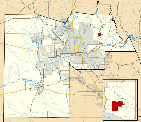
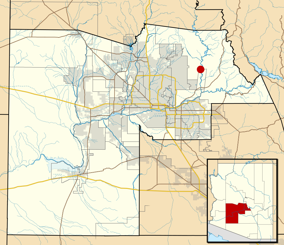
| Тасвир | This map shows the incorporated areas and Indian reservation boundaries in Maricopa County, Arizona, along with water bodies and major highways and roads. Rio Verde is highlighted in red. Other incorporated cities are shown in gray, planning area borders for these cities and Indian reservation borders are shown as solid black lines. Changes from Previous Version: Updated the maps to include water bodies and to make "less boring" than the plain black/white/gray maps. Format was updated to match standards laid out by WikiProject Maps/Conventions. Map data is based on data from the following Webpage: Maricopa County Interactive GIS Map. I created this map in Inkscape. |
| Дата | |
| Чыганак | My own work, based on government information |
| Автор | Ixnayonthetimmay |
| Рөхсәт (Бу файлны кабат куллану) |
Public Domain |
| Башка юрамалар | See Category:Maps of Maricopa County for other versions of this image. |
Лицензияләү
| Я, владелец авторских прав на это произведение, передаю его в общественное достояние. Это разрешение действует по всему миру. В некоторых странах это не может быть возможно юридически, в таком случае: Я даю право кому угодно использовать данное произведение в любых целях без каких-либо условий, за исключением таких условий, которые требуются по закону. |
Файл тарихы
Файлның нинди булганлыгын күрү өчен «дата/вакыт» дигәненә басыгыз.
| Дата/вакыт | Кече рәсем | Үлчәмнәре | Кулланучы | Искәрмә | |
|---|---|---|---|---|---|
| агымдагы | 19 май 2011, 06:49 | | 940 × 812 (1,05 Мб) | Ixnayonthetimmay | Uploading new version |
| 30 авг 2008, 04:37 |  | 900 × 800 (421 Кб) | Ixnayonthetimmay | == Summary == {{Information |Description=This map shows the incorporated areas and unincorporated areas in Maricopa County, Arizona. [[:en:Paloma, Arizona|Pa | |
| 15 сен 2007, 23:39 |  | 900 × 800 (385 Кб) | Ixnayonthetimmay | == Summary == {{Information |Description=This map shows the incorporated areas in Maricopa County, Arizona. It also shows the boundaries for the municipal planning areas. [[:en:Rio Verd | |
| 28 май 2007, 09:43 |  | 900 × 780 (336 Кб) | Ixnayonthetimmay | ||
| 31 гый 2007, 03:03 |  | 904 × 758 (177 Кб) | Ixnayonthetimmay | {{Information |Description=This map shows the incorporated areas in Maricopa County, Arizona, highlighting Rio Verde in red. It also shows the boundaries for t |
Файлны куллану
Әлеге файл киләсе битне куллана:
Файлның гомуми кулланышы
Әлеге файл аста бирелгән викиларда куллана:
- ar.wikipedia.org проектында куллану
- azb.wikipedia.org проектында куллану
- ca.wikipedia.org проектында куллану
- ceb.wikipedia.org проектында куллану
- de.wikipedia.org проектында куллану
- eu.wikipedia.org проектында куллану
- fa.wikipedia.org проектында куллану
- fr.wikipedia.org проектында куллану
- it.wikipedia.org проектында куллану
- sr.wikipedia.org проектында куллану
- www.wikidata.org проектында куллану
- zh-min-nan.wikipedia.org проектында куллану
- zh.wikipedia.org проектында куллану