Файл:Badami-chalukya-empire-map.svg

Төп файл (SVG файлы, шартлы 1510 × 1753 нокта, файлның зурлыгы: 339 Кб)
Тасвирлама
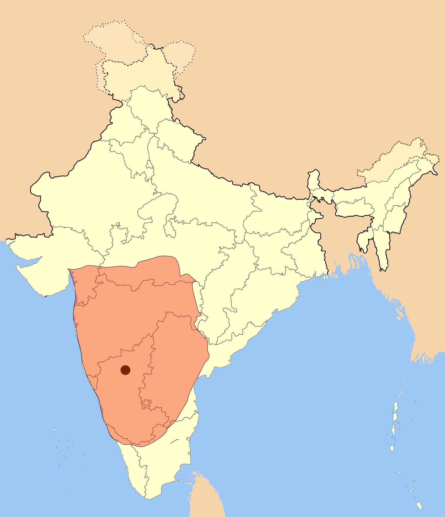
I used Image:India-locator-map-blank.svg as base and edited myself using inkspace and created it by looking at the following source.
Suryanath U. Kamat, A Concise history of Karnataka from pre-historic times to the present, Jupiter books, MCC, Bangalore, 2001 (Reprinted 2002) OCLC: 7796041 p327
A province of this empire comprising of Andhra region became the "Eastern Chalukyas" in the years following the death of Pulakesi II.
Note: Original source has overlay of Kadamba, Rastrakuta and Western Ganga kingdom maps on the same page, I placed only the Badami Chalukya empire map.
| Тасвир | Badami Chalukya Empire Map |
| Дата | |
| Чыганак | Үз эшем |
| Автор | Mlpkr |
Лицензияләү

|
Бу документтан күчермә алырга, аны таратырга һәм/яки үзгәртергә Ирекле программалар фонды тарафыннан бастырылган 1.2 һәм соңрак чыгарышлы GNU Free Documentation License шартлары буенча хакыгыз бар, әмма үзгәрмәс бүлекләрсез, алгы һәм арткы тышлыктагы текстсыз. Лицензиянең күчермәсе GNU Free Documentation License исемле бүлеккә кертелгән. |
| Әлеге файл Creative Commons Attribution-Share Alike 3.0 Unported лицензиясе буенча рөхсәт ителгән. | ||
| ||
| Этот признак лицензирования был добавлен к этому файлу как часть обновления лицензии GFDL. |
- Сез ирекле рәвештә:
- уртаклашырга – бу язмадан күчермә алырга, таратырга һәм тапшырырга
- юрамалар ясау – бу язманы үзгәртергә
- Түбәндәге шартларда:
- атрибуция – Сез тиешле бәя, лицензиягә сылтама бирергә һәм үзгәрешләр кертелгәнме-юкмы икәнен күрсәтергә тиешсез. Сез моны теләсә-нинди дөрес булган ысул белән эшли аласыз, әмма лицензиар сезне яки куллануыгызны хуплый дигән фикер калырга тиеш түгел.
- шул ук кагыйдәләр буенча таратыла – Әгәр сез бу әсәрне үзгәртәсез, әверелдерәсез яки аның нигезендә яңаны булдырасыз, башлангыч әсәрнең рөхсәтнамәсен яки башлангыч рөхсәтнамәгә туры килә торган рөхсәтнамәне кулланырга тиешсез.
Файл тарихы
Файлның нинди булганлыгын күрү өчен «дата/вакыт» дигәненә басыгыз.
| Дата/вакыт | Кече рәсем | Үлчәмнәре | Кулланучы | Искәрмә | |
|---|---|---|---|---|---|
| агымдагы | 19 июл 2017, 00:28 | | 1510 × 1753 (339 Кб) | Renato de Carvalho Ferreira | Ajustes gerais |
| 27 май 2007, 22:49 |  | 1651 × 1753 (432 Кб) | Mlpkr | I used Image:India-locator-map-blank.svg as base and edited myself using inkspace and created it by looking at the following source. Suryanath U. Kamat, A Concise history of Karnataka from pre-historic times to the present, Jupiter books, MCC, Bangalore | |
| 26 май 2007, 23:09 |  | 1651 × 1753 (432 Кб) | Mlpkr | == Summary == I used Image:India-locator-map-blank.svg as base and edited myself using inkspace and created it by looking at the following source. Suryanath U. Kamat, A Concise history of Karnataka from pre-historic times to the present, Jupiter books, | |
| 26 май 2007, 22:25 |  | 1651 × 1753 (431 Кб) | Mlpkr | {{Information |Description= |Source=self-made |Date= |Author= User:Mlpkr }} |
Файлны куллану
Әлеге файл киләсе битне куллана:
Файлның гомуми кулланышы
Әлеге файл аста бирелгән викиларда куллана:
- ar.wikipedia.org проектында куллану
- ba.wikipedia.org проектында куллану
- bn.wikipedia.org проектында куллану
- ca.wikipedia.org проектында куллану
- da.wikipedia.org проектында куллану
- en.wikipedia.org проектында куллану
- es.wikipedia.org проектында куллану
- fi.wikipedia.org проектында куллану
- fr.wikipedia.org проектында куллану
- gu.wikipedia.org проектында куллану
- hi.wikipedia.org проектында куллану
- hu.wikipedia.org проектында куллану
- hy.wikipedia.org проектында куллану
- id.wikipedia.org проектында куллану
- it.wikipedia.org проектында куллану
- ja.wikipedia.org проектында куллану
- ka.wikipedia.org проектында куллану
- kn.wikipedia.org проектында куллану
- ko.wikipedia.org проектында куллану
- lt.wikipedia.org проектында куллану
- ml.wikipedia.org проектында куллану
- mr.wikipedia.org проектында куллану
- ms.wikipedia.org проектында куллану
Бу файлның гомуми кулланышын карау.