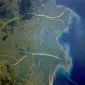
Файл:Godavari satellite view.jpg

Алдан карауның зурлыгы: 600 × 600 нокта. Башка ачыклык: 240 × 240 нокта | 480 × 480 нокта | 768 × 768 нокта | 1024 × 1024 нокта | 2048 × 2048 нокта | 5248 × 5248 нокта.
Төп файл (5248 × 5248 нокта, файл зурлыгы: 8,05 Мб, MIME төре: image/jpeg)
Файл тарихы
Файлның нинди булганлыгын күрү өчен «дата/вакыт» дигәненә басыгыз.
| Дата/вакыт | Кече рәсем | Үлчәмнәре | Кулланучы | Искәрмә | |
|---|---|---|---|---|---|
| агымдагы | 4 мар 2018, 19:27 |  | 5248 × 5248 (8,05 Мб) | Ras67 | levels adjusted |
| 4 мар 2018, 19:24 |  | 5248 × 5248 (8,28 Мб) | Ras67 | high resolution | |
| 21 окт 2008, 23:11 |  | 640 × 640 (128 Кб) | File Upload Bot (Magnus Manske) | {{BotMoveToCommons|fr.wikipedia}} {{Information |Description={{fr|les deltas de la Godâvarî et de la Krishnâ STS034-077-029 Godavari and Krishna River Deltas, India October 1989 The mouths of the Godavari River (east) and the Krishna River (wes |
Файлны куллану
Әлеге файл киләсе битне куллана:
Файлның гомуми кулланышы
Әлеге файл аста бирелгән викиларда куллана:
- af.wikipedia.org проектында куллану
- ar.wikipedia.org проектында куллану
- arz.wikipedia.org проектында куллану
- ast.wikipedia.org проектында куллану
- az.wikipedia.org проектында куллану
- bh.wikipedia.org проектында куллану
- br.wikipedia.org проектында куллану
- ca.wikipedia.org проектында куллану
- ce.wikipedia.org проектында куллану
- cy.wikipedia.org проектында куллану
- de.wikivoyage.org проектында куллану
- el.wikipedia.org проектында куллану
- en.wikipedia.org проектында куллану
- en.wiktionary.org проектында куллану
- eo.wikipedia.org проектында куллану
- es.wikipedia.org проектында куллану
- eu.wikipedia.org проектында куллану
- fi.wikipedia.org проектында куллану
- fr.wikivoyage.org проектында куллану
- ga.wikipedia.org проектында куллану
- gl.wikipedia.org проектында куллану
- ha.wikipedia.org проектында куллану
- he.wikipedia.org проектында куллану
- hy.wikipedia.org проектында куллану
- id.wikipedia.org проектында куллану
- it.wikipedia.org проектында куллану
- ka.wikipedia.org проектында куллану
- mr.wikipedia.org проектында куллану
- ne.wikipedia.org проектында куллану
- new.wikipedia.org проектында куллану
- nn.wikipedia.org проектында куллану
- no.wikipedia.org проектында куллану
- os.wikipedia.org проектында куллану
- pa.wikipedia.org проектында куллану
- pl.wikipedia.org проектында куллану
- pnb.wikipedia.org проектында куллану
- ps.wikipedia.org проектында куллану
- pt.wikipedia.org проектында куллану
- ru.wikipedia.org проектында куллану
- sa.wikipedia.org проектында куллану
Бу файлның гомуми кулланышын карау.

